Danyaya Global Village: The World in One Place
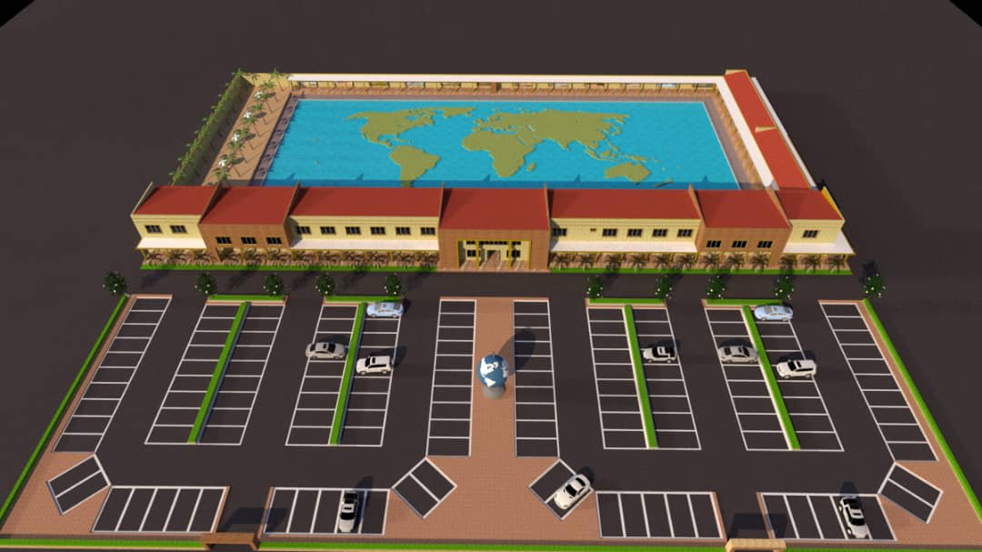
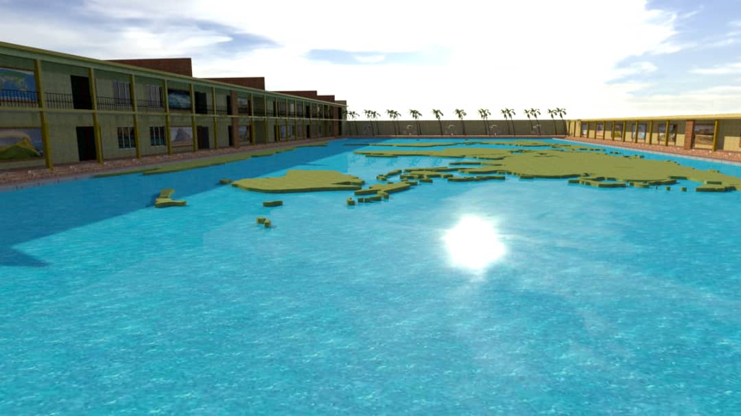
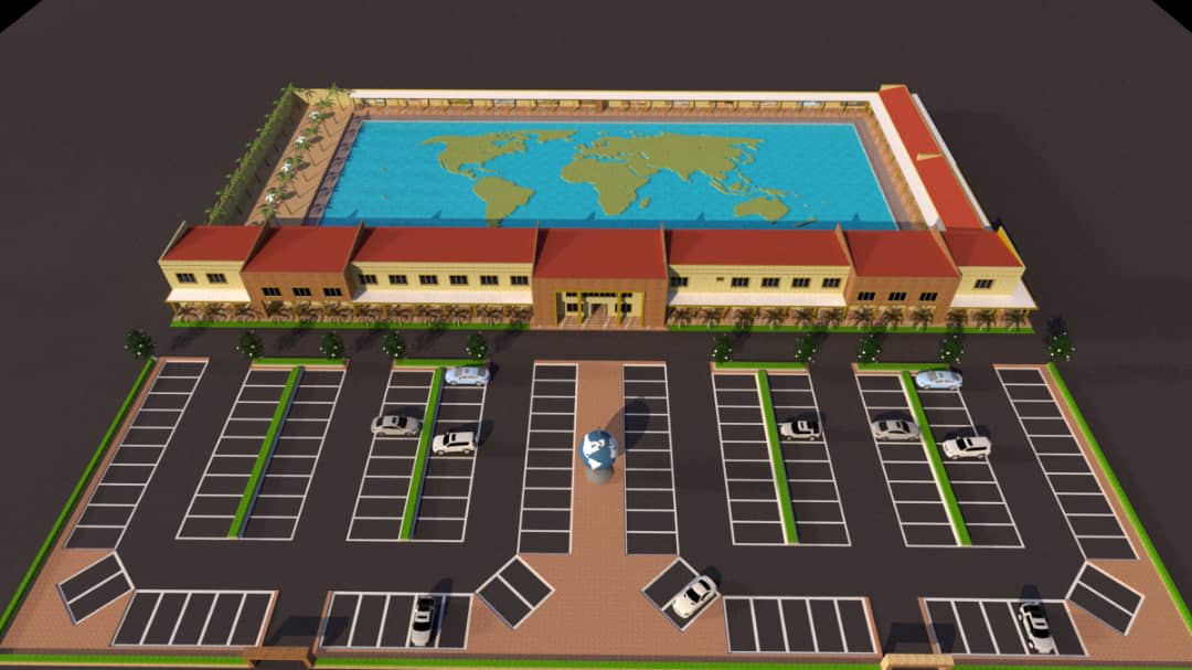
Danyaya Global Village is a large, walkable physical miniature of the world, designed to bring continents, countries, oceans, rivers, lakes, mountains, deserts, forests, and famous landmarks together in one location. Visitors can move across the globe, explore major physical features, and learn about different countries, cultures, and environments through direct experience.
Objectives
The objective of Danyaya Global Village is to create an accessible, immersive, and educational representation of the world in one location. The project is designed to help visitors understand the geographical arrangement of continents, countries, oceans, rivers, lakes, mountains, deserts, forests, and other major physical features through direct physical exploration. It also aims to promote cultural awareness, tourism education, environmental understanding, and curiosity by allowing visitors to move through different regions of the world, observe major landmarks, and appreciate the natural and human diversity of the Earth.
Problem Being Addressed
Many people learn about the world mainly through books, maps, photographs, and digital screens, which can make geography difficult to understand in a practical and memorable way. There is also limited access to facilities where visitors can physically explore the relationship between continents, countries, oceans, rivers, mountains, deserts, landmarks, and other major features of the Earth. Danyaya Global Village addresses this gap by transforming the world map into a large, walkable physical environment. It enables visitors to see how different parts of the world are connected, understand the locations of major natural and human features, and move physically from one country or continent to another. The project also responds to limited opportunities for affordable tourism education and cultural exposure. By bringing major geographical features and landmarks together in one place, it allows students, families, tourists, and communities to experience the diversity of the world without the cost and difficulty of international travel.
Inspiration
The inspiration for Danyaya Global Village came from the desire to make the world easier to understand through direct physical experience. Danyaya envisioned a place where visitors could move beyond ordinary maps and pictures by walking across a miniature representation of the globe and seeing how continents, countries, oceans, rivers, mountains, deserts, forests, and famous landmarks are connected. His international travels, exposure to different cultures, and interest in education, tourism, and innovation also influenced the concept. The project reflects his belief that people learn more effectively when they can see, explore, and interact with what they are studying. He was further inspired by the idea of bringing global knowledge closer to students, families, and communities who may not have the opportunity to travel internationally. By recreating the world in one location, the project offers an accessible way to promote geographical understanding, cultural awareness, curiosity, and appreciation of the diversity of the Earth.
Materials and Technologies Used
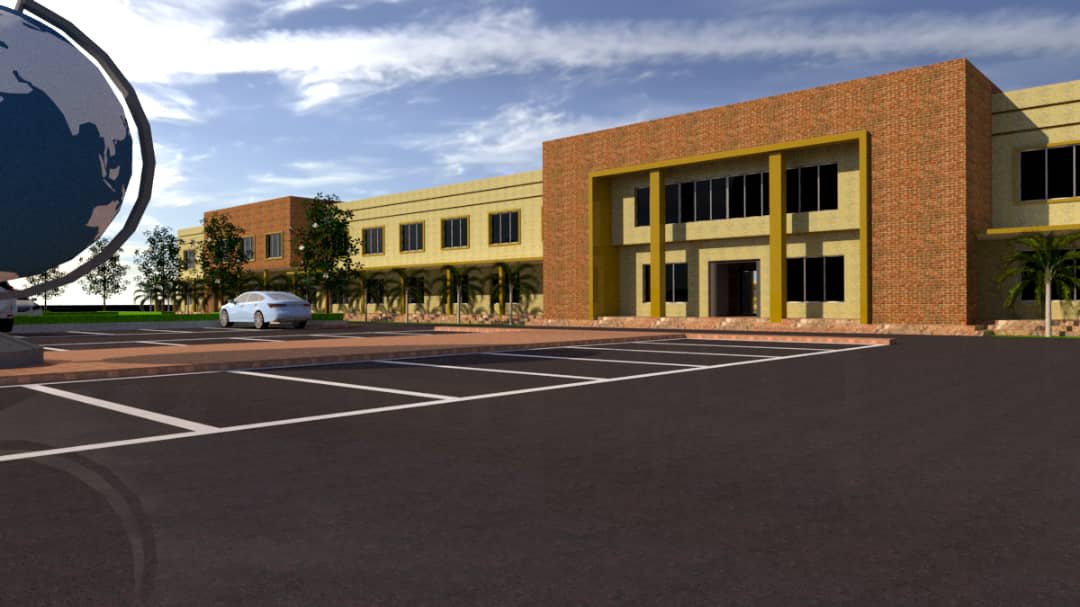
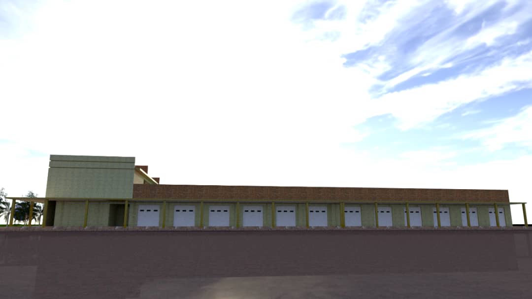
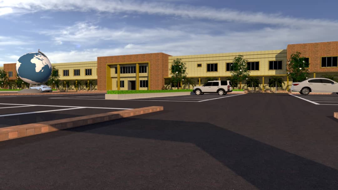
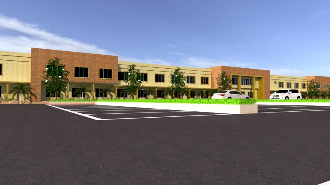
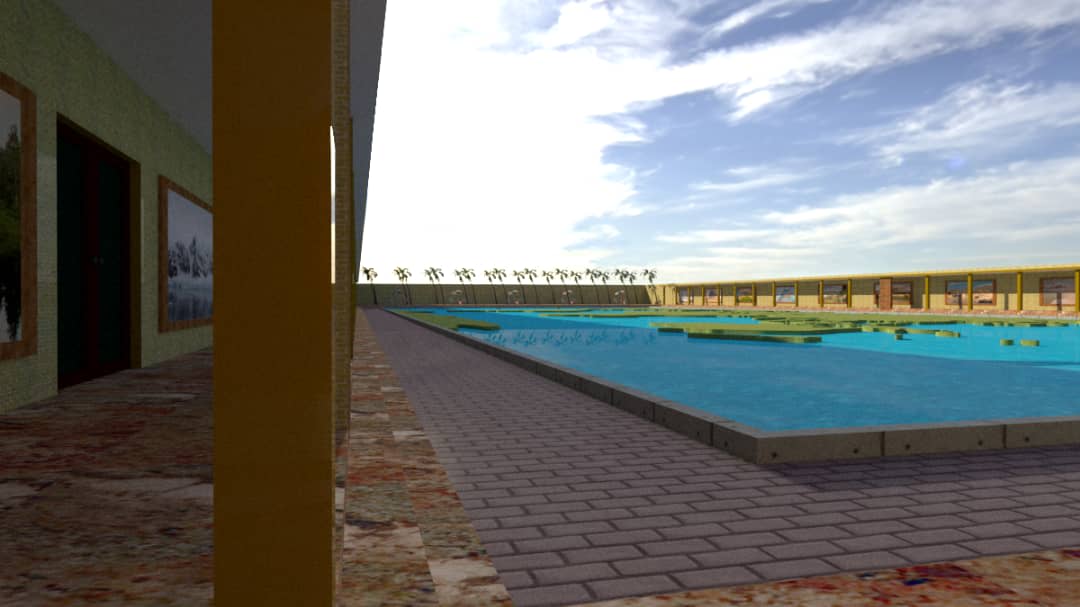
Danyaya Global Village requires a combination of construction materials, landscaping elements, water systems, physical models, and educational display technologies. The main world map is formed on the ground using durable materials such as reinforced concrete, paving materials, metal supports, fibre structures, moulded components, and weather resistant finishes. The continents, countries, islands, and major landforms are shaped physically to reflect their geographical positions and relative forms. Mountains, valleys, plateaus, deserts, forests, waterfalls, volcanoes, glaciers, and other natural features are created with suitable modelling materials, stone, sand, artificial vegetation, sculpted surfaces, and specialised finishes. Oceans, seas, rivers, and lakes are represented with real water. Pumps, pipes, drainage channels, filtration systems, reservoirs, and circulation equipment are used to maintain the movement and cleanliness of the water. Bridges, walkways, stepping paths, and protective barriers allow visitors to move safely across and around the different water features. Miniature landmarks and notable structures are produced using model making techniques, architectural drawings, fabricated components, moulds, wood, metal, glass, fibre, and other suitable materials. Signs, flags, labels, maps, lighting, and information panels help visitors identify countries, capitals, physical features, and important landmarks. The wider complex also includes separate offices, exhibition spaces, learning areas, and virtual reality laboratories. These facilities use computers, virtual reality headsets, screens, sound systems, projectors, digital media, and other equipment to provide additional educational and tourism experiences beyond the physical globe. By combining civil construction, landscaping, water engineering, architectural modelling, lighting, signage, and digital technology, the project creates a durable and interactive representation of the world in one location.
Educational and Social Value
Danyaya Global Village has significant educational value because it allows visitors to learn geography through direct observation and physical exploration. Students can walk across continents, identify countries, trace rivers, observe mountain ranges, cross representations of oceans and seas, and understand the relationship between major physical and human features of the world. The project can support lessons in geography, environmental studies, history, tourism, culture, architecture, and international relations. It provides schools with an engaging destination for excursions, practical demonstrations, guided tours, and experiential learning activities that may be more memorable than classroom instruction alone. Socially, the Global Village creates an inclusive space where families, students, tourists, and community groups can learn and interact. It makes global knowledge and tourism experiences more accessible to people who may not have the opportunity to travel internationally. The project also promotes cultural awareness and respect by introducing visitors to the landmarks, identities, environments, and traditions of different countries. By presenting the world as a connected physical space, it encourages curiosity, tolerance, environmental appreciation, and a broader understanding of humanity’s shared global home.
Gallery